
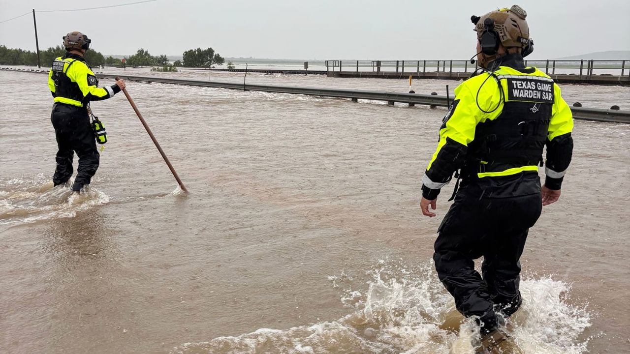
SOUTHEAST TEXAS — Tropical Storm Edouard moved ashore Tuesday afternoon near Johnson Bayou, Louisiana, after rapidly strengthening while approaching the Gulf Coast, bringing flooding rain, powerful wind gusts and storm surge to communities across southeastern Texas and southwestern Louisiana.
The storm developed quickly over the Gulf, organizing from a tropical rainstorm Sunday into a named storm Monday. That rapid intensification gave coastal communities little time to prepare for worsening conditions.
By the time Edouard approached land, its maximum sustained winds had reached 60 mph, with stronger gusts reported in some locations.
Forecasters warned of a storm surge of 3 to 6 feet along much of the upper Texas coast and southwestern Louisiana, adding another threat to areas already dealing with heavy rainfall.
Power Outages Spread Across Southeast Texas
Conditions became increasingly dangerous after Edouard reached the coast.
In Beaumont, widespread flooding and power outages were reported across Jefferson County, with damaging winds contributing to the disruption.
By nightfall Tuesday, power outages across southeast Texas had climbed to nearly 82,000, leaving tens of thousands of customers without electricity.
Meteorologists and emergency officials had warned that the storm could rapidly become more dangerous as it approached the coastline.
One emergency management official compared tropical systems to a slow burn, explaining that conditions can intensify quickly as a storm gets closer to landfall.
That proved to be the case with Edouard, as winds and heavy rainfall increased substantially Tuesday.
Flooding Creates Dangerous Travel Conditions
Emergency officials urged motorists in Port Arthur, Texas, to stay off flooded roads as water began covering roadways.
The combination of heavy rain, rising water and strong winds created difficult conditions for drivers and emergency crews.
In Taylor Landing, Texas, storm damage was also reported, with power poles and trees knocked down by strong winds.
The impacts were particularly concerning because Edouard was producing significant rainfall while also pushing additional water toward the coast.
Officials continued warning residents to avoid unnecessary travel and to remain alert as flooding conditions developed.
Heavy Rain Threat Continues Into Wednesday
The flooding threat is expected to continue even as Edouard begins weakening.
A corridor of 2 to 8 inches of rain is forecast around Houston and the upper Texas coast through Wednesday. A narrower area east of Houston could receive 8 to 12 inches of rainfall, creating the potential for additional flooding.
Rainfall totals were already significant in parts of southeast Texas.
Beaumont recorded more than 6.66 inches of rain after sunset Tuesday, while another report near Sabine Pass showed 5.58 inches.
Because soils and drainage systems can become overwhelmed when heavy rain falls quickly, even additional rainfall after the storm’s landfall could create localized flooding.
Edouard Expected to Weaken Inland
Edouard is expected to weaken rapidly Wednesday as it moves farther inland across southeastern Texas. However, weakening does not mean the danger immediately disappears.
Tropical downpours could continue producing localized flooding, particularly in areas that have already received several inches of rain.
Additional tropical moisture is also expected to keep showers and thunderstorms in the Gulf Coast forecast later this week.
Residents should therefore continue monitoring local weather alerts even after the storm loses tropical-storm strength.
Texas Activates Emergency Response
Texas Gov. Greg Abbott activated the Texas Division of Emergency Management for around-the-clock operations as the storm approached.
State agencies were directed to prepare to assist communities dealing with flooding, storm damage and power outages.
ERCOT, which manages most of Texas’ electrical grid, was also preparing for elevated electricity demand because of hot weather affecting eastern and southeastern parts of the state.
At the same time, state emergency resources remained involved in wildfire response operations elsewhere in Texas, creating an additional challenge for emergency officials managing multiple threats.
Edouard is the third tropical storm to make landfall along this section of the Gulf Coast in 2026, following Arthur in June and Bertha in July.
Although Edouard is expected to weaken inland, officials continue to warn that flooding remains the primary concern into Wednesday, particularly across southeast Texas and areas near Houston.
Did your area experience flooding, power outages or storm damage from Edouard? Share your experience in the comments below.
One thought on “Edouard Brings 3–6 Foot Storm Surge and Torrential Rain to Gulf Coast as Flooding Threat Continues Into Wednesday”