
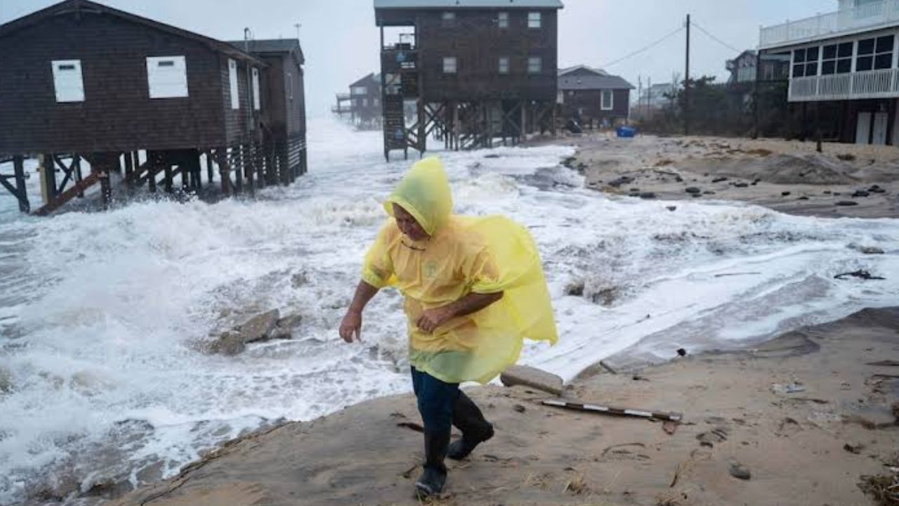
New York, New York — A developing storm could strengthen into a nor’easter along the Mid-Atlantic coast this week, bringing the potential for flooding, powerful wind gusts, beach erosion and dangerous surf from North Carolina to the Northeast.
The storm’s eventual track and intensity will determine how severe the impacts become. But forecasters are already watching the system closely because much of the region has received repeated rainfall since the weekend, leaving some areas more vulnerable to additional flooding.
The threat could increase later this week if the storm strengthens closer to the coastline.
Storm Could Bring Days of Heavy Rain
A series of storms has been moving eastward along a frontal boundary stretching from the northern and central Plains through the Midwest.
Some of the rainfall from that pattern has already reached the Mid-Atlantic coast. As another weather system develops, unsettled conditions could linger across a large portion of the region.
Meteorologists said:
“As a large buckle develops in the jet stream due to a blocking pattern, the storms moving through the Midwest will stall,”
That atmospheric setup could keep clouds, drizzle, fog and periods of heavy rain across areas stretching from the Carolinas to Ohio, Pennsylvania and New Jersey into Tuesday.
Some locations could receive enough additional rainfall to produce flash flooding and significant travel delays.
Coastal Areas Face Growing Flood Risk
The storm’s eventual position will be critical.
If the system develops and strengthens closer to the coast, the threat of heavy rain, strong winds and pounding surf would increase substantially.
Forecasters say the storm could initially move offshore before potentially drifting back toward the coast later in the week.
That scenario could bring the storm closer to heavily populated coastal communities, increasing the potential for widespread impacts.
A track close to the coastline could produce enough rain to cause flooding, particularly in areas that have already been soaked since Saturday night.
Full Moon Could Make Coastal Flooding Worse
Another factor could make coastal flooding more significant.
The full moon will raise astronomical tide levels later this week, meaning the ocean will already be running at higher tide levels before the storm potentially pushes water farther inland.
Coastal flooding is considered likely around high tide from North Carolina through New York between Tuesday and Friday.
The threat could continue along the northern Mid-Atlantic coast and potentially expand into southeastern New England this weekend.
Communities along the shoreline could therefore face multiple rounds of elevated water levels rather than a single brief period of coastal flooding.
Dangerous Surf Could Develop Offshore
The storm could also create hazardous marine conditions.
Depending on how strong the nor’easter becomes, dangerously rough seas could develop offshore, with wave conditions potentially comparable to those produced by a hurricane or a strong winter nor’easter.
That would create serious concerns for boaters and other people venturing onto the water.
Small-craft operators are being urged to closely monitor the forecast, particularly as the storm’s track and intensity become clearer.
Beach communities could also experience additional erosion as large waves and elevated water levels combine along the coastline.
3 Tropical Systems Could Develop This Weekend as Mexico and the Southwest Watch Closely
Power Outages and Travel Problems Possible
A stronger nor’easter could create a wide range of disruptions.
Flooding rain could make roads difficult or impossible to travel, while strong wind gusts could bring down trees and power lines and cause scattered outages.
Coastal flooding could also affect roads, low-lying neighborhoods and waterfront infrastructure, particularly during periods of high tide.
The combination of rain, wind and rough surf could make conditions especially challenging for communities that experience all three threats at once.
Cooler Autumn Weather Is Arriving
While the storm could bring unsettled conditions, cooler air is also spreading into the Northeast.
Meteorologists said:
“Regardless of the severity of the nor’easter, there will be no shortage of cool autumn air in the Northeast, especially over the Appalachians this week,”
Temperatures will generally remain in the 50s and 60s Fahrenheit across the mountains, while coastal areas could see highs in the 60s to lower 70s.
The timing is notable because autumn officially arrives at 8:05 p.m. EDT on Tuesday.
For now, residents along the Mid-Atlantic and Northeast coasts will need to watch how the developing storm evolves. A small change in its track could make a significant difference in rainfall, wind and coastal flooding impacts.
Are you in the path of the potential nor’easter? Share your city and state in the comments and let us know whether you’re preparing for heavy rain, strong winds or coastal flooding this week.