
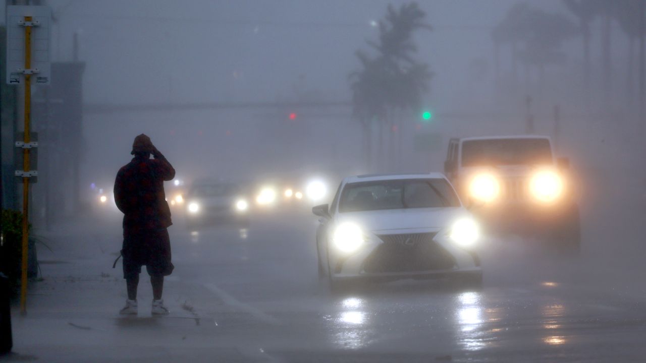
Florida, USA — The Sunshine State could be heading toward a very wet end to September, with tropical moisture helping fuel repeated rounds of showers and thunderstorms across the state throughout the week.
Forecasters are watching a pattern that could keep rain moving across Florida as strong easterly winds push moisture inland. The combination of abundant tropical moisture and slow-moving storms could result in periods of heavy rainfall, particularly where thunderstorms repeatedly move over the same areas.
The unsettled weather is expected to continue through the weekend, keeping parts of Florida under the threat of additional downpours.
Tropical moisture is driving the wet pattern
The latest weather setup is being influenced by a large area of high pressure over the eastern United States, which is helping strengthen easterly winds across Florida.
Those winds can transport moisture from the Atlantic toward the state, creating favorable conditions for frequent showers and thunderstorms.
Unlike fast-moving storms that quickly pass through an area, some of these showers could move slowly or repeatedly develop over the same locations. That raises the possibility of locally intense rainfall over short periods.
Rainfall rates could exceed 1 to 2 inches per hour in the heaviest storms, according to the information provided.
That type of rainfall can quickly overwhelm drainage systems and lead to localized flooding, particularly in areas that receive several rounds of storms.
Miami could see several more inches of rain
Among Florida’s major cities, Miami is facing the possibility of additional significant rainfall as the wet pattern continues.
The city could pick up 2 to 3 inches of rain through Sunday, with the unsettled weather already having begun earlier in the week.
The repeated rainfall could add substantially to Miami’s September precipitation total. Exactly how much rain ultimately falls will depend on where the heaviest thunderstorms develop and how long the wet pattern persists.
Because thunderstorms can produce highly localized rainfall, totals may vary considerably even between nearby locations.
Rainfall expectations are drawing attention
The unusually wet weather is also attracting attention from prediction markets.
Kalshi markets are currently pricing probabilities for Miami’s rainfall total by the end of September, reflecting expectations surrounding the ongoing wet pattern.
According to the figures provided, there is a 74% chance of Miami receiving more than 9 inches of rain by the end of September.
The market also places a 59% chance on rainfall exceeding 10 inches for the month.
These figures represent prediction-market probabilities rather than official weather forecasts, and they can change as new weather information becomes available.
Texas Beaches Face Red Tide Warning as Toxic Algae Triggers Respiratory Problems
More storms could arrive before the weekend ends
For residents across Florida, the weather pattern means the possibility of more frequent rain, thunderstorms and locally heavy downpours over the coming days.
The greatest rainfall totals are likely to depend on where storms repeatedly develop or stall. Even when widespread severe weather does not occur, persistent heavy rain can create travel problems and localized flooding.
Drivers should be prepared for sudden reductions in visibility and water-covered roads when intense thunderstorms move through.
The unsettled conditions are expected to remain a feature of the Florida weather pattern through the weekend, potentially giving the Sunshine State a soggy finish to September.
Residents should continue checking updated local forecasts, especially before traveling, as storm timing and rainfall amounts can change.
How has the rainy weather been in your part of Florida? Share your experience in the comments.